Summary
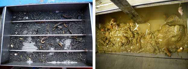
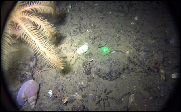
Frobisher Bay, NU, like many Arctic coastal marine systems, is undergoing rapid anthropogenic and climatic change. Limited scientific work has been conducted in the bay in the past 40 years, some of which has included seabed ecological surveys in select areas. By collecting sediments (Figure 1) and underwater video (Figure 2) we are resampling these areas to determine if their ecology has shifted with human development and changing climate, and also to establish baseline knowledge as development intensifies and the climate continues to warm. We will also be increasing the scope of research in Frobisher Bay to learn how seabed habitats are distributed throughout the bay on a broader scale. The product of this broader scale habitat mapping will be maps showing the distribution of seabed habitats in their current state. This information will be vital to future decision makers as we collectively attempt to gauge the impact of climate change and development on seabed habitats in the Arctic.
Figure 1. Fine clay sediment and seabed organisms washed from a seabed sample (left), and full seabed substrate with fine sediments and organisms (right) from Frobisher Bay Long-term Ecology sites.
Figure 2. Image from underwater video taken in Frobisher Bay at Habitat Mapping study site.
Study Site Locations
Frobisher Bay (Iqaluit, NU)
Local Collaborations
Government of Nunavut, Department of Environment (Janelle Kennedy, Alex Flaherty)
Project Contact
Long-term Ecology
Dr. Alec Aitken, Professor, University of Saskatchewan, alec.aitken@usask.ca, (306) 966-5672
Erin Herder, MSc Student, Memorial University of Newfoundland, h03ech@mun.ca, (709) 864-8034
Habitat Mapping
Dr. Evan Edinger, Professor, Memorial University of Newfoundland, eedinger@mun.ca, (709) 864-3233
Ben Misiuk, PhD Student, Memorial University of Newfoundland, bmisiuk@mun.ca, (709) 864-6127

