Infrastructure in the Canadian Arctic is being affected by climate change impacts such as permafrost thaw, coastal erosion, and changing temperatures and precipitation patterns. With this in mind, the Standards Council of Canada established the Northern Infrastructure Standardization Initiative
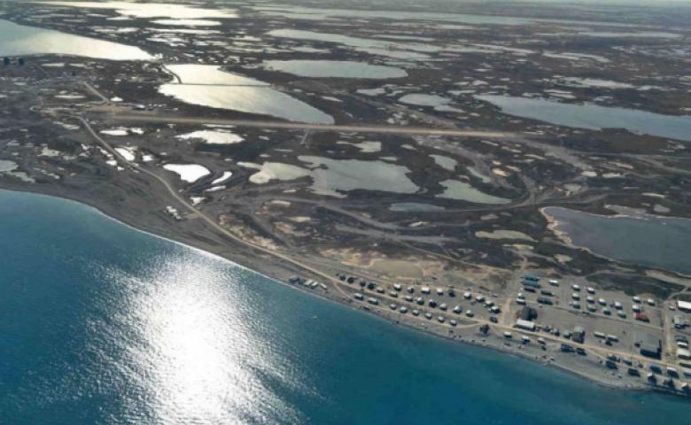
Hall Beach is located on the shore of Foxe Basin on the Melville Peninsula. With a current population of just above 720, it was created when a Distant Early Warning (DEW) Line site was built in the area in 1957 to help monitor Canadian air space in the Far North. Though the DEW line is no longer operational, there is a more technologically advanced North Warning System radar site in the community that replaces it.
In the late 1950s and 1960s, Inuit moved from surrounding camps to work around the DEW line site and the community was born. Hall Beach is considered one of the more traditional communities in Nunavut. The traditional name for Hall Beach is Sanirayak, or “one that is on the coast.” It’s a spectacular place to see walruses, seals, waterfowl and other arctic wildlife.